
Unity Books
Queen's Atlas: Saxton's Elizabethan Masterpiece
Queen's Atlas: Saxton's Elizabethan Masterpiece
Couldn't load pickup availability
A cartographic snapshot of late Tudor England, gorgeously reproduced with the first county maps of England and Wales.
Nowadays, we take for granted the ready availability of maps of all kinds, but in Tudor England, maps were rare. All this changed in 1579 when Christopher Saxton, a farmer from the West Riding of Yorkshire, became the first cartographer to make a published atlas of all the counties of England and Wales. This book traces the story of Saxton's life and legacy by reconstructing his extraordinary mapmaking project alongside the crucial nature of the support and encouragement he received from Queen Elizabeth I and her court.
Saxton's atlas became the template for most detailed maps of the country for almost two centuries. For many, his atlas provided the first detailed image of England and Wales they had ever seen, showing the Elizabethan kingdom as a whole and in its constituent parts. This lavishly illustrated book reproduces all of Saxton's county maps together with many other drawings revealing the forebears and successors of this groundbreaking work. Today, Saxton's maps give us an invaluable cartographic snapshot of late Tudor England.
Materials
Materials
Shipping & Returns
Shipping & Returns
Dimensions
Dimensions
Care Instructions
Care Instructions
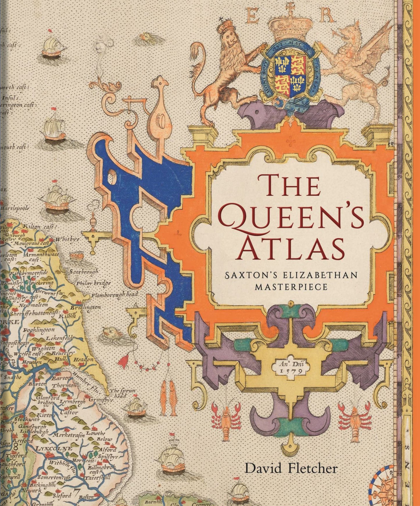
Image with text
Pair text with an image to focus on your chosen product, collection, or blog post. Add details on availability, style, or even provide a review.
-
Free Shipping
Pair text with an image to focus on your chosen product, collection, or blog post. Add details on availability, style, or even provide a review.
-
Hassle-Free Exchanges
Pair text with an image to focus on your chosen product, collection, or blog post. Add details on availability, style, or even provide a review.